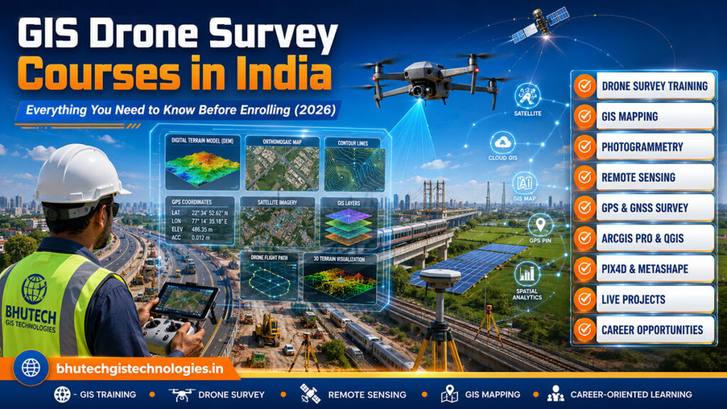
Bhutech GIS Technologies provides advanced GIS & Remote Sensing services, professional GIS training, drone mapping, photogrammetry, and geospatial solutions across India. Empowering civil engineering, agriculture, environment, and infrastructure sectors with data-driven insights.
Remote Sensing Services
GIS Mapping & Drone Survey
At Bhutech GIS Technologies, we specialize in providing cutting-edge GIS and Remote Sensing solutions tailored to the needs of diverse sectors, including civil engineering, environmental management, urban planning, agriculture, and more.
With a strong presence in Madhya Pradesh and Karnataka, we proudly deliver services across India—offering high-quality GIS training, advanced mapping solutions, geospatial data analysis, and customized GIS applications designed to empower decision-making and drive innovation.


Certified GIS Professionals
Lorem ipsum production of solar electricity, you are less dependent on the power grid and its pricing policy. There are no moving mechanisms and components in the solar power plant.
WhatsApp us