
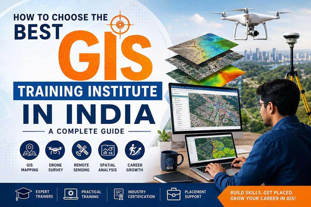
The demand for skilled GIS professionals is growing rapidly across India. Government projects, Smart Cities, infrastructure development, utilities, transportation, environmental management, agriculture, telecom, and engineering companies are increasingly using Geographic Information Systems (GIS) to improve planning and decision-making.
As the geospatial industry expands, many institutes now offer GIS courses. However, not every institute provides the same quality of education, practical training, or career support. Choosing the best GIS Training Institute in India can make a significant difference in your technical skills, confidence, and future career opportunities.
🌍 “Choosing the right GIS institute isn’t just about earning a certificate—it’s about gaining practical skills that employers value.”
📌 What You’ll Learn in This Guide
- ✅ How to identify a quality GIS Training Institute in India
- ✅ Essential GIS software every student should learn
- ✅ Importance of Drone Survey & Remote Sensing training
- ✅ Questions to ask before joining a GIS course
- ✅ Career opportunities and future scope
- ✅ Common mistakes to avoid while choosing an institute
📚 Table of Contents
- 🎯 Why Choosing the Right GIS Institute Matters
- 🌍 What is GIS?
- 🇮🇳 Why GIS Careers Are Growing in India
- ✅ 10 Things to Check Before Joining a GIS Training Institute
- 💻 GIS Software You Should Learn
- 🚁 Drone Survey & Remote Sensing
- 💼 Career Opportunities
- 💰 Salary & Future Scope
- ❓ Frequently Asked Questions
🎯 Why Choosing the Right GIS Training Institute Matters
A GIS course is an investment in your future. While many institutes advertise GIS training, the quality of education can vary significantly. A good institute focuses on practical learning, real-world projects, updated software, and career preparation—not just classroom theory.
Employers today look for candidates who can confidently work with spatial data, create professional maps, analyze geographic information, and use modern GIS software in real projects. Learning these skills from an experienced institute increases your chances of securing rewarding career opportunities.
Industry-Oriented Curriculum
Courses should cover current industry requirements instead of outdated concepts.
Career Readiness
Practical projects, portfolio development, and interview preparation improve employability.
Hands-on Practice
Real GIS datasets and live exercises help students gain confidence.
🌍 What is GIS?
Geographic Information System (GIS) is a technology used to collect, manage, analyze, and visualize location-based information. It combines maps, satellite imagery, GPS data, drone surveys, and databases to solve real-world problems and support informed decision-making.
GIS is used by government agencies, engineering companies, utility providers, environmental organizations, logistics firms, telecom operators, and many other industries where geographic information plays a critical role.
Digital Mapping
Create accurate digital maps for planning, navigation, and infrastructure development.
Spatial Analysis
Analyze geographic data to identify patterns and support better decisions.
Remote Sensing
Use satellite imagery and aerial data for environmental monitoring and planning.
Drone Mapping
Generate high-accuracy maps, terrain models, and survey data using drones.
🇮🇳 Why GIS Careers Are Growing in India
India’s geospatial sector continues to grow due to major investments in infrastructure, transportation, renewable energy, Smart Cities, Digital India initiatives, land record modernization, and utility management. Organizations increasingly rely on GIS professionals to analyze location-based information and improve project planning.
This growing demand has created excellent career opportunities for students and professionals trained in GIS Mapping, Drone Survey, Remote Sensing, GPS Surveying, and Spatial Data Analysis.
📈 Industry Insight
GIS professionals are now employed across construction, engineering, urban planning, agriculture, mining, telecom, environmental management, disaster response, and government departments. Learning GIS today can prepare you for a wide range of career paths in India’s expanding geospatial industry.
🚀 Continue to Part 1B
Next, we’ll cover the 10 most important factors to consider before choosing a GIS Training Institute in India, including trainers, curriculum, software, live projects, certifications, placement support, and more.
—b
✅ 10 Things to Check Before Joining a GIS Training Institute in India
Selecting the right GIS Training Institute in India requires more than comparing course fees. The quality of training, practical exposure, software, trainers, and placement assistance will directly influence your career. Before enrolling, evaluate the following important factors.
1️⃣ Check the Institute’s Industry Experience
An institute with strong industry experience understands current market requirements better than one that focuses only on classroom teaching. Experienced institutes continuously update their curriculum according to the latest GIS technologies and employer expectations.
Industry Expertise
Choose an institute that understands real GIS workflows used in engineering, infrastructure, utilities, and government projects.
Updated Curriculum
Modern GIS technologies evolve quickly. Updated course content keeps your skills relevant.
Real Applications
Learning from practical industry examples helps students understand real project requirements.
✔ Pro Tip: Before joining, explore the institute’s website, blogs, student work, and training modules to understand their expertise.
2️⃣ Experienced Trainers Matter
The quality of instructors plays one of the biggest roles in your learning journey. Trainers with industry experience can explain practical workflows, common project challenges, and professional best practices that go beyond textbooks.
- ✔ Practical GIS knowledge
- ✔ Infrastructure project experience
- ✔ Drone Survey knowledge
- ✔ Remote Sensing expertise
- ✔ Real GIS project exposure
- ✔ Interactive teaching approach
🎓 Great trainers don’t just teach software—they teach you how professionals solve real-world GIS problems.
3️⃣ Learn Industry-Standard GIS Software
The best GIS Training Institute in India should provide practical exposure to software widely used by engineering firms, infrastructure companies, government agencies, and GIS service providers.
ArcGIS Pro
Professional GIS mapping, analysis, cartography, and geodatabase management.
QGIS
Popular open-source GIS software for spatial analysis and digital mapping.
ERDAS Imagine
Advanced satellite image processing and remote sensing analysis.
Global Mapper
Terrain analysis, LiDAR processing, and geospatial data management.
Pix4D / Metashape
Drone photogrammetry, orthomosaic generation, DEMs, and 3D mapping.
AutoCAD Map 3D
Engineering design integrated with GIS workflows.
4️⃣ Practical Training & Live Projects
Theory alone is not enough. Employers expect GIS professionals who can confidently work on live datasets and complete practical assignments. Project-based learning helps students build confidence and develop problem-solving skills.
🛣 Infrastructure Mapping
Roads, railways, airports, metro, and highway projects.
🏙 Smart City Projects
Urban planning, municipal assets, and digital city mapping.
⚡ Utility Mapping
Electricity, telecom, gas pipelines, and water distribution.
🌱 Environmental Projects
Forest monitoring, watershed management, and conservation planning.
💡 Practical learning develops:
- Problem-solving ability
- Project documentation
- GIS workflow understanding
- Confidence during interviews
- Professional portfolio development
5️⃣ Drone Survey & Remote Sensing Modules
Modern GIS careers increasingly require knowledge of Drone Survey and Remote Sensing. Institutes that include these technologies provide students with valuable practical exposure to the latest geospatial workflows.
Drone Survey
Flight planning, aerial mapping, orthomosaics, contour generation, and 3D terrain models.
Remote Sensing
Satellite imagery interpretation, land use mapping, vegetation analysis, and environmental monitoring.
GPS & GNSS
Field data collection, survey techniques, and spatial accuracy.
🚀 Students who learn GIS along with Drone Survey and Remote Sensing often have broader career opportunities in engineering, infrastructure, utilities, mining, agriculture, and environmental management.
📖 Continue to Part 2
In the next section, we’ll cover:
✅ Placement Support & Certifications
✅ Online vs Offline GIS Training
✅ Questions to Ask Before Joining
✅ Career Opportunities After GIS Training
✅ Salary Guide (2026)
✅ Frequently Asked Questions
✅ Final Conclusion
6️⃣ Placement Assistance & Career Support
One of the most important factors while selecting a GIS Training Institute in India is placement assistance. Learning GIS software is valuable, but getting guidance for interviews, resume building, and industry exposure can significantly improve your chances of securing a job.
Resume Building
Create a professional GIS resume highlighting technical skills, projects, and software expertise.
Interview Preparation
Mock interviews and technical question sessions help students build confidence.
Placement Guidance
Career counseling, internship support, and interview opportunities with GIS companies.
7️⃣ Online vs Offline GIS Training
Today, many institutes provide both classroom and online GIS courses. Each learning mode has its own advantages depending on your schedule, location, and learning preferences.
| Online Training | Offline Training |
|---|---|
|
✔ Learn from anywhere |
✔ Classroom interaction |
💡 Tip: Choose an institute that offers practical assignments and live project support regardless of whether the training is online or offline.
8️⃣ Industry Certification
A recognized certificate demonstrates your learning and technical competence. However, employers usually value practical skills and project experience more than certificates alone.
- ✔ GIS Course Completion Certificate
- ✔ Drone Survey Training Certificate
- ✔ Remote Sensing Training
- ✔ Practical Project Portfolio
- ✔ Internship Experience (if available)
9️⃣ Questions to Ask Before Joining a GIS Institute
Before enrolling, ask these important questions to ensure you’re selecting the right institute.
- ❓ Is the curriculum updated regularly?
- ❓ Which GIS software will I learn?
- ❓ Are Drone Survey and Remote Sensing included?
- ❓ Will I work on live projects?
- ❓ Is placement guidance available?
- ❓ What industries hire previous students?
- ❓ Is technical support available after course completion?
- ❓ Will I receive practical assignments?
🔟 Career Opportunities After GIS Training
Completing a professional course from a GIS Training Institute in India can lead to opportunities across numerous industries where location intelligence plays a vital role.
🗺 GIS Analyst
Create maps, manage geodatabases, and perform spatial analysis.
🚁 Drone Survey Engineer
Conduct aerial surveys and generate accurate mapping outputs.
🛰 Remote Sensing Analyst
Interpret satellite imagery and environmental datasets.
📍 GIS Technician
Maintain GIS databases and support mapping projects.
🏗 GIS Engineer
Support infrastructure, highways, metro, and utility projects.
🌍 Geospatial Consultant
Provide GIS consulting services for government and private organizations.
💰 Expected GIS Salary in India (2026)
| Experience | Expected Salary |
|---|---|
| Freshers | ₹2.5–5 LPA |
| 2–4 Years | ₹5–8 LPA |
| 5+ Years | ₹8–15+ LPA |
| Senior GIS Consultant | ₹15–25+ LPA |
🚀 Future Scope of GIS in India
The future of GIS is driven by emerging technologies such as Artificial Intelligence (AI), Cloud GIS, Digital Twins, Internet of Things (IoT), 3D City Models, Drone Mapping, and Big Data Analytics. As India’s infrastructure and digital transformation projects expand, skilled GIS professionals will continue to be in high demand.
❓ Frequently Asked Questions (FAQs)
Is GIS a good career in India?
Yes. GIS professionals are in demand across infrastructure, engineering, utilities, government departments, agriculture, mining, telecom, and environmental sectors.
Who can join a GIS course?
Engineering students, science graduates, surveyors, architects, planners, environmental professionals, and working professionals can pursue GIS training.
Do GIS courses include Drone Survey?
Many professional GIS institutes now include Drone Survey, GPS Survey, Photogrammetry, and Remote Sensing modules.
Which GIS software should I learn?
ArcGIS Pro, QGIS, Global Mapper, ERDAS Imagine, AutoCAD Map 3D, Pix4D, and Agisoft Metashape are among the most widely used tools.
Is placement assistance important?
Yes. Institutes that provide career guidance, interview preparation, and placement support can help students transition into professional roles more effectively.
🎯 Final Thoughts
Choosing the best GIS Training Institute in India is one of the most important decisions for building a successful career in the geospatial industry. Focus on institutes that provide experienced trainers, practical projects, modern GIS software, Drone Survey training, Remote Sensing, updated course content, and strong placement assistance.
By investing in quality GIS education today, you can prepare yourself for rewarding opportunities in infrastructure, smart cities, engineering, environmental management, utilities, transportation, and many other growing industries.
🌍 Start learning today, build practical GIS skills, and prepare for a successful career in India’s rapidly growing geospatial industry.
📞 Why Choose Bhutech GIS Technologies?
- ✅ Practical GIS Training
- ✅ Drone Survey & Remote Sensing
- ✅ Industry-Experienced Trainers
- ✅ Live Projects & Hands-on Practice
- ✅ GIS Mapping & Spatial Analysis
- ✅ Career Guidance & Placement Support
- ✅ Online & Offline Learning Options
🌟 Why Bhutech GIS Technologies?
If you’re searching for a GIS Training Institute in India that combines practical learning with industry-focused education, choosing the right training partner is essential. At Bhutech GIS Technologies, our goal is to help students, engineers, surveyors, and professionals develop real-world geospatial skills that employers value.
Expert Trainers
Learn from experienced GIS professionals with practical industry knowledge.
Hands-on GIS Training
Practice GIS Mapping, Spatial Analysis, Georeferencing, Digitization, and Database Management.
Drone Survey Training
Gain practical knowledge of Drone Mapping, Photogrammetry, Orthomosaic generation, DEM, and Contour Mapping.
Remote Sensing
Work with satellite imagery, land-use mapping, image classification, and environmental analysis.
Career Guidance
Resume preparation, interview guidance, live projects, and placement assistance.
Latest Curriculum
Updated training covering current GIS technologies, AI, Web GIS, Drone Survey, and industry workflows.
📚 Related GIS Courses
A professional GIS Training Institute in India should offer learning beyond traditional GIS software. Expanding your knowledge in complementary geospatial technologies helps increase career opportunities.
🗺 GIS Mapping Course
Digital Mapping, Cartography, Spatial Analysis & Geodatabases.
🚁 Drone Survey Course
Drone Flight Planning, Photogrammetry & Survey Mapping.
🛰 Remote Sensing Course
Satellite Image Processing and Environmental Monitoring.
📍 GPS Survey Training
GPS, GNSS, Coordinate Systems and Field Survey Techniques.
🌐 Web GIS
Interactive Online GIS Applications using Web Technologies.
🤖 AI in GIS
Artificial Intelligence for Geospatial Data Analysis.
📈 Why the Demand for GIS Professionals is Increasing
India is investing heavily in Smart Cities, highways, railways, metro projects, renewable energy, utility networks, digital mapping, and geospatial technologies. These initiatives are creating strong demand for skilled GIS professionals with expertise in mapping, surveying, drone technology, and spatial analysis.
Industries Hiring GIS Professionals
- 🏗 Civil Engineering
- 🛣 Highway Projects
- 🚆 Railways & Metro
- ⚡ Utility Mapping
- 🏙 Smart Cities
- 🌱 Agriculture
- 🌳 Forestry
- 🌊 Water Resources
- ⛏ Mining
- 📡 Telecom
- 🌍 Environmental Consulting
- 🏛 Government Organizations
💡 Final Conclusion
Finding the best GIS Training Institute in India is more than selecting a course—it’s about choosing an institute that provides practical learning, modern software training, live projects, experienced trainers, and career support.
Whether you’re a student, civil engineer, surveyor, architect, planner, or working professional, developing skills in GIS Mapping, Drone Survey, Remote Sensing, GPS Survey, Web GIS, and Spatial Analysis can significantly improve your career opportunities in India’s expanding geospatial industry.
Before enrolling, compare institutes based on curriculum, software, trainers, certifications, practical exposure, and placement support. Investing in quality GIS education today can help you build a successful and future-ready career.
🚀 Start your GIS journey today and prepare for exciting career opportunities in India’s growing geospatial industry.
❓Quick FAQs
Which is the best GIS Training Institute in India?
The best institute offers experienced trainers, practical GIS software training, Drone Survey, Remote Sensing, live projects, updated curriculum, and placement support.
How long does a GIS course take?
Most professional GIS courses range from 1 to 6 months, depending on the syllabus and specialization.
Can beginners learn GIS?
Yes. Most GIS courses start with the fundamentals and gradually move to advanced topics such as Drone Survey, Remote Sensing, and Spatial Analysis.
What software should I learn?
ArcGIS Pro, QGIS, Global Mapper, ERDAS Imagine, AutoCAD Map 3D, Pix4D, Agisoft Metashape, and Web GIS tools are highly recommended.
Is GIS a good career in 2026?
Yes. GIS continues to be one of the fastest-growing technology fields, driven by Smart Cities, infrastructure development, AI, Drone Survey, and digital transformation initiatives.
📞 Ready to Build Your GIS Career?
Bhutech GIS Technologies
🎓 GIS Training Institute in India
🚁 Drone Survey Training
🛰 Remote Sensing Courses
🗺 GIS Mapping & Spatial Analysis
💼 Career-Oriented Practical Training
🌐 Visit: https://bhutechgistechnologies.in