
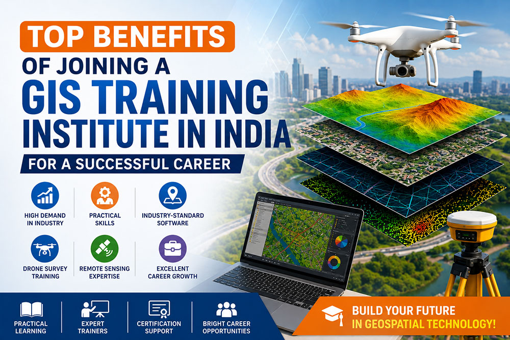
The demand for GIS professionals has increased significantly in recent years. Organizations across India are investing in Geographic Information Systems (GIS), Drone Survey, Remote Sensing, Smart City development, Infrastructure Planning, Utility Mapping, Environmental Management, and Digital Land Records.
If you are planning to build a career in the geospatial industry, choosing the right GIS Training Institute in India is one of the smartest decisions you can make. A professional GIS training program provides practical skills, industry exposure, software knowledge, and career opportunities that help you stay ahead in today’s competitive job market.
🌍 “GIS is no longer just a mapping technology—it’s becoming the backbone of modern infrastructure, smart cities, engineering, agriculture, and digital transformation.”
📌 In This Guide You’ll Learn
- ✅ Why GIS is becoming one of India’s fastest-growing technologies
- ✅ Top benefits of joining a GIS Training Institute in India
- ✅ Career opportunities after GIS training
- ✅ Essential GIS software and practical skills
- ✅ Industries hiring GIS professionals
- ✅ Future scope of GIS, Drone Survey & Remote Sensing
📚 Table of Contents
- 🌍 What is GIS?
- 🇮🇳 Why GIS is Growing in India
- 🎓 Benefits of Joining a GIS Training Institute
- 💻 Skills You’ll Learn
- 🛰️ Drone Survey & Remote Sensing
- 🏢 Industries Using GIS
- 💼 Career Opportunities
- 💰 Salary & Future Scope
- ❓ Frequently Asked Questions
🌍 What is GIS?
Geographic Information System (GIS) is a powerful technology used to collect, store, analyze, manage, and visualize geographical information. It combines maps, GPS, satellite imagery, drone data, and spatial databases to help organizations make accurate, data-driven decisions.
Today, GIS plays an important role in sectors like infrastructure development, transportation, construction, agriculture, mining, utilities, environmental monitoring, urban planning, disaster management, and telecommunications.
Digital Mapping
Create accurate digital maps using satellite imagery, GPS, and survey data.
Spatial Analysis
Analyze geographic information to improve planning and business decisions.
Remote Sensing
Interpret satellite images and aerial data for environmental and infrastructure projects.
Drone Mapping
Capture high-accuracy aerial data for surveying and engineering applications.
🇮🇳 Why GIS is Growing Rapidly in India
India is witnessing rapid growth in infrastructure, transportation, renewable energy, urban planning, and digital governance. Government initiatives such as Smart Cities Mission, Digital India, PM Gati Shakti, and land record modernization are driving the adoption of GIS technology across the country.
As a result, organizations are looking for professionals with expertise in GIS Mapping, Drone Survey, Remote Sensing, GPS Surveying, Spatial Data Analysis, and Geospatial Technologies.
📈 Industry Insight
The Indian geospatial sector continues to expand as businesses adopt AI-powered GIS, cloud-based mapping, drone technology, and digital twins for smarter decision-making.
🎓 Benefit #1 — High Industry Demand
One of the biggest advantages of joining a GIS Training Institute in India is the growing demand for skilled GIS professionals. Companies are actively recruiting candidates who can work with mapping software, spatial databases, drone data, and satellite imagery.
🏗 Infrastructure
Roads, highways, metro, airports, and railways require GIS professionals.
🏙 Smart Cities
Urban planning and municipal development rely heavily on GIS technologies.
⚡ Utilities
Electricity, telecom, gas, and water networks use GIS for asset management.
🚀 Benefit #2 — Practical Skills That Employers Value
A professional GIS training institute focuses on practical learning instead of theory alone. Students gain hands-on experience using industry-standard software and real project datasets, making them more confident and job-ready.
- ✔ GIS Mapping
- ✔ GPS & GNSS Survey
- ✔ Spatial Data Analysis
- ✔ Cartography
- ✔ Drone Mapping Basics
- ✔ Remote Sensing Fundamentals
- ✔ Geospatial Database Management
💼 Benefit #3 — Diverse Career Opportunities
Unlike many specialized fields, GIS offers career opportunities across multiple industries. After completing your training, you can work with engineering firms, government departments, GIS consulting companies, environmental organizations, utility providers, mining companies, agricultural technology firms, and smart city projects.
GIS Analyst
Create maps, analyze spatial data, and support business decisions.
Drone Survey Engineer
Conduct drone mapping and infrastructure survey projects.
Remote Sensing Analyst
Interpret satellite imagery for planning and environmental monitoring.
GIS Engineer
Support construction, highways, utilities, and engineering projects.
🚀 Continue Reading Part 1B:
In the next section, we’ll cover Benefits #4–#10, GIS course modules, industry software, Drone Survey & Remote Sensing training, and the skills that employers expect in 2026.
# Part 1B – Benefits #4–#10, GIS Course Modules & Industry Skills
“`html id=”x8g7pb”
📚 Benefit #4 — Learn Industry-Standard GIS Software
A leading GIS Training Institute in India provides hands-on training with the software used by government departments, engineering companies, infrastructure consultants, and GIS service providers.
Learning professional GIS software significantly improves your employability and prepares you for real-world projects.
ArcGIS Pro
Create professional maps, perform spatial analysis, and manage geodatabases.
QGIS
Open-source GIS software widely used for mapping and data visualization.
ERDAS Imagine & ENVI
Process satellite imagery and perform remote sensing analysis.
Pix4D & Metashape
Generate orthomosaics, DEMs, and 3D models from drone imagery.
🚁 Benefit #5 — Drone Survey & Mapping Skills
Drone Surveying has become an essential part of modern infrastructure, engineering, mining, and land development projects. Learning how to integrate drone data with GIS provides a strong competitive advantage.
Drone Survey Skills
- ✔ Flight Planning
- ✔ Ground Control Points (GCP)
- ✔ Orthomosaic Generation
- ✔ Digital Elevation Models (DEM)
- ✔ Contour Mapping
- ✔ Volume Calculations
- ✔ 3D Terrain Modeling
🛰️ Benefit #6 — Remote Sensing Knowledge
Remote Sensing allows professionals to analyze the Earth’s surface using satellite imagery and aerial photography. When combined with GIS, it supports environmental monitoring, agriculture, disaster management, water resource planning, and urban development.
🌾 Agriculture
Crop monitoring and precision farming.
🌳 Forests
Forest cover analysis and conservation.
🌊 Water Resources
Watershed management and flood analysis.
🏙️ Urban Planning
Land use and infrastructure planning.
🎯 Benefit #7 — Project-Based Learning
The best GIS institutes focus on practical projects rather than theory alone. Working on real-world datasets helps students understand industry workflows and build a strong portfolio.
- ✔ Utility Mapping
- ✔ Road Network Analysis
- ✔ Land Use & Land Cover Mapping
- ✔ Smart City Projects
- ✔ Environmental Analysis
- ✔ Infrastructure Planning
- ✔ Asset Management
🏢 Benefit #8 — Career Opportunities Across Multiple Industries
GIS professionals are not limited to a single industry. Almost every sector that uses location-based information requires GIS expertise.
🏗 Construction
Infrastructure planning and engineering projects.
🚆 Transportation
Roads, railways, airports, and metro systems.
⚡ Utilities
Electricity, telecom, gas, and water distribution.
🌍 Government
Smart Cities, land records, disaster management, and planning.
⛏ Mining
Mineral exploration and resource management.
🌱 Agriculture
Precision agriculture and irrigation planning.
📈 Benefit #9 — Strong Career Growth & Salary Potential
As organizations increasingly adopt geospatial technologies, experienced GIS professionals can progress into senior technical, consulting, and management roles.
| Experience | Typical Salary |
|---|---|
| Freshers | ₹2.5–5 LPA |
| 2–4 Years | ₹5–8 LPA |
| 5+ Years | ₹8–15+ LPA |
🚀 Benefit #10 — Future-Proof Career
The future of GIS is closely connected with Artificial Intelligence, Cloud GIS, IoT, Digital Twins, autonomous drones, and high-resolution satellite imagery. Professionals who develop GIS skills today will be well-positioned for tomorrow’s geospatial industry.
Emerging Technologies in GIS
- 🤖 Artificial Intelligence (AI)
- ☁ Cloud GIS
- 🌐 Web GIS
- 📡 Internet of Things (IoT)
- 🏙 Digital Twin Technology
- 🚁 Autonomous Drone Mapping
- 📊 Big Data Analytics
📖 Typical Course Modules
🗺 GIS Fundamentals
Maps, projections, coordinate systems, and geodatabases.
📍 GPS & GNSS
Surveying principles and field data collection.
📊 Spatial Analysis
Overlay, buffer, interpolation, and network analysis.
🌍 Cartography
Professional map design and visualization.
🚁 Drone Mapping
Photogrammetry and aerial surveying fundamentals.
🛰 Remote Sensing
Satellite image processing and interpretation.
💡 Key Takeaway
Joining a professional GIS Training Institute in India is more than learning mapping software—it’s about building practical geospatial skills, gaining exposure to modern technologies like Drone Survey and Remote Sensing, and preparing for long-term career growth in one of India’s fastest-growing technology sectors.
📌 Coming in Part 2:
Career Opportunities • Top Job Roles • Salary Guide • How to Choose the Best GIS Training Institute in India • FAQs • Final Conclusion
💼 Career Opportunities After Completing GIS Training
Completing a course from a GIS Training Institute in India opens doors to exciting career opportunities across government organizations, multinational companies, engineering consultancies, GIS service providers, environmental agencies, utility companies, and infrastructure firms.
As GIS technology continues to expand across India, professionals with practical GIS skills are increasingly valued for planning, mapping, surveying, and data-driven decision-making.
GIS Analyst
Create thematic maps, perform spatial analysis, manage geodatabases, and support planning projects.
Drone Survey Engineer
Capture aerial data, generate orthomosaics, contour maps, and 3D terrain models.
Remote Sensing Analyst
Analyze satellite imagery for environmental monitoring and infrastructure planning.
GIS Engineer
Support highways, metro, railway, utility, and smart city projects.
Survey Engineer
Conduct GPS, GNSS, Total Station, and Drone-based surveys.
Geospatial Consultant
Deliver GIS consulting services for public and private organizations.
🏢 Top Industries Hiring GIS Professionals
🏙 Smart Cities
Urban planning, traffic management, municipal asset mapping, and city development.
🛣 Infrastructure
Roads, bridges, airports, highways, industrial corridors, and railways.
⚡ Utilities
Electricity, telecom, gas pipeline, and water distribution mapping.
🌾 Agriculture
Precision farming, irrigation planning, crop monitoring, and land analysis.
🌳 Environment
Forest management, biodiversity, pollution monitoring, and disaster management.
⛏ Mining
Mine planning, geological mapping, exploration, and resource management.
💰 GIS Salary in India (2026)
Salary depends on practical skills, certifications, software expertise, project experience, and the hiring organization.
| Experience | Expected Salary |
|---|---|
| Freshers | ₹2.5–5 LPA |
| 1–3 Years | ₹4–7 LPA |
| 3–5 Years | ₹6–10 LPA |
| Senior Professionals | ₹10–18+ LPA |
🚀 Future Scope of GIS in India
The Indian geospatial industry is expected to experience substantial growth over the coming years due to increasing investments in digital infrastructure, infrastructure development, AI-powered mapping, and smart city initiatives.
🤖 Artificial Intelligence
AI-powered GIS analysis and predictive mapping.
☁ Cloud GIS
Cloud-based geospatial platforms for collaboration.
🌐 Web GIS
Interactive online mapping applications and dashboards.
📡 IoT Integration
Real-time asset monitoring using GIS and IoT.
🏙 Digital Twins
Virtual city models for infrastructure planning.
🚁 Drone Automation
AI-assisted drone mapping and inspection technologies.
🎯 How to Choose the Best GIS Training Institute in India
- ✅ Experienced Trainers with Industry Knowledge
- ✅ Practical GIS Software Training
- ✅ Live Project Experience
- ✅ Drone Survey & Remote Sensing Modules
- ✅ Updated Curriculum
- ✅ Internship Opportunities
- ✅ Career Guidance & Placement Support
- ✅ Online & Offline Learning Options
- ✅ Industry-Recognized Certification
- ✅ Continuous Learning Resources
❓ Frequently Asked Questions
1. Is GIS a good career in India?
Yes. GIS professionals are increasingly required in infrastructure, engineering, utilities, government projects, mining, environmental management, and agriculture.
2. Who can join a GIS course?
Students, civil engineers, surveyors, architects, planners, environmental professionals, and science graduates can pursue GIS training.
3. Do I need programming knowledge?
No. Most GIS courses begin with the fundamentals. Programming such as Python can be learned later for GIS automation.
4. Does GIS include Drone Survey?
Many modern GIS institutes include Drone Survey, Photogrammetry, GPS Survey, and Remote Sensing modules as part of their curriculum.
5. Which GIS software should I learn?
ArcGIS Pro, QGIS, Global Mapper, ERDAS Imagine, ENVI, Pix4D, Agisoft Metashape, and AutoCAD Map 3D are widely used in the industry.
6. Is GIS suitable for Civil Engineers?
Absolutely. GIS plays a vital role in surveying, road design, utilities, construction planning, and smart city development.
⭐ Why Choose Bhutech GIS Technologies?
📌 Final Thoughts
Joining a professional GIS Training Institute in India is one of the best investments for students and professionals who want to build a successful career in the rapidly growing geospatial industry. With practical training in GIS, Drone Survey, Remote Sensing, GPS Survey, and industry-standard software, you can develop the skills needed for today’s and tomorrow’s job market.
Whether your goal is to work in infrastructure, engineering, environmental management, utilities, smart cities, or government projects, GIS provides diverse career opportunities and long-term professional growth. Start learning today and become part of India’s digital geospatial transformation.
📞 Ready to Start Your GIS Career?
Bhutech GIS Technologies
🎓 GIS Training Institute in India
🚁 Drone Survey Courses
🛰 Remote Sensing Training
🗺 GIS Mapping & Spatial Analysis
🌐 Practical Industry-Focused Learning
“`